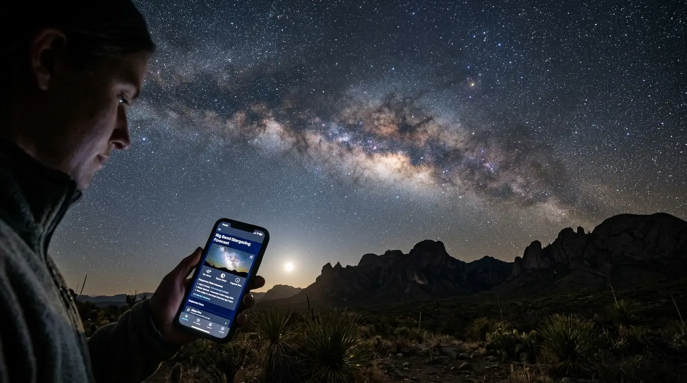

Bortle Class 1 Is Necessary, Not Sufficient
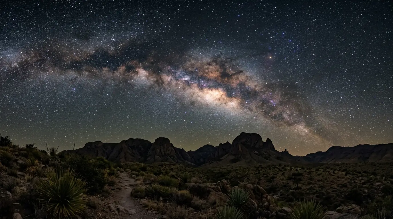
Big Bend National Park carries the darkest rating the Bortle scale has to give: it's widely rated as Bortle Class 1, among the darkest skies documented in the United States. That number describes the ceiling. It says nothing about tonight.
A cloud bank rolling in from Mexico, a gibbous moon rising at 11pm, or a patch of high haze can undercut a Bortle Class 1 sky just as easily as a nearby city's glow does. The three variables that actually decide whether your one clear night at Big Bend delivers the view the Bortle rating promises are cloud cover, moon phase, and atmospheric transparency, and every one of them is checkable in advance, days out, not just the moment you step outside the tent.
Big Bend's remoteness raises the stakes on getting this right. Most visitors commit to a multi-day trip before they know which of those days will actually deliver clear, dark, moonless conditions. Forecasting well is how you turn a three-night stay into at least one genuinely good session, instead of hoping the sky cooperates on whichever night happens to be free.
Moon Phase Is the Lever You Can Plan Around
Of the three variables, moon phase is the one you can plan for weeks ahead, because lunar cycles are fixed and public well before your trip. A full moon floods the sky with reflected sunlight, easily bright enough to wash out the Milky Way's faint dust lanes and drown all but the brightest stars in scattered light, far outshining any planet in the sky.
New moon falls at the opposite end of that scale. During a new moon, the moon isn't visible in the night sky at all, which creates the darkest conditions for stargazing[1], and it's the single most reliable way to get more out of a Bortle Class 1 site like Big Bend. On a new moon night in a Bortle 3 or darker location, the Milky Way's galactic core appears three-dimensional, with dark dust lanes clearly visible[2]; Big Bend sits two full Bortle classes darker than that reference point, so the same effect shows up with even more contrast.
Half-moon nights are a reasonable middle ground, not a write-off. A half-moon is generally reckoned to be about one-sixth as bright as a full moon, which still leaves a genuinely dark window, especially in the hours after it sets or before it rises. Check moonrise and moonset times, not just the phase, because a half-moon that sets at 10pm hands you the rest of the night as if it were a new moon.
Check moonrise and moonset times, not just the phase, because a half-moon that sets at 10pm hands you the rest of the night as if it were a new moon.
Reading a Real Astronomy Forecast, Not a Weather App
A standard weather app tells you tomorrow's chance of rain in the nearest town. It says almost nothing about whether the sky above a specific overlook will be clear enough for a three-hour exposure at 2am. Astronomy-specific forecasting tools are built for a different question.
The Clear Sky Chart (still widely known by its older name, Clear Dark Sky) is specifically intended for amateur astronomers, with data from a forecast model developed by Allan Rahill of the Canadian Meteorological Center[3]. It renders as a color-coded grid: cloud cover, transparency, seeing, darkness, and wind, plotted hour by hour across the coming few nights rather than a single daily icon.
Clear Outside does similar work through a cleaner interface built for astronomers, breaking cloud cover, transparency, seeing, humidity, and wind down hour by hour across the coming nights. For Big Bend, enter Panther Junction or Chisos Basin as your location rather than the nearest town on either tool. Neither service runs a Big Bend-specific model; both apply the same general atmospheric prediction layer used everywhere else, narrowed down to your coordinates.
3 nights
Check either tool no more than three days out. Forecast models this granular lose reliability past that window, and Big Bend's remoteness means you're likely committing to the drive before you can fully trust any single night's chart.
Planetarium Apps for Knowing What You're Looking At
Forecasting only tells you whether the sky will be clear. It doesn't tell you where the Milky Way's core will sit relative to the horizon at 11pm, or whether Jupiter clears the ridge before you pack up for the night. That's what a planetarium app answers.
Recommended tours
Tours are selected for quality, not commission. I earn a small fee if you book — at no extra cost to you.

Stellarium is free and open-source, rendering an accurate real-time sky from your exact location complete with constellation lines, deep sky objects, and satellite passes[4]. Set your location to Big Bend's coordinates rather than the nearest town in the app's database, and it renders the sky for any date and hour you choose, months in advance, so you can plan a session around when the galactic core clears the Chisos Mountains' silhouette instead of guessing.
Featured · Destination
Big Bend National Park
Big Bend National Park is Bortle Class 1, the darkest rating the Bortle scale has. What that dark sky rating means on the ground, and the best months to go.
Run it before you leave home, on a laptop with a real screen, to scout which of Big Bend's stargazing spots gives the clearest sightline to the core at the hour you'll actually be there. Once you're under the sky itself, switch to a phone version with a red-light night mode; a full-brightness phone screen costs you ten or more minutes of dark adaptation every time you check one.
Where These Tools Fall Short at Big Bend
None of the three tools above were built with Big Bend specifically in mind. Clear Sky Chart, Clear Outside, and Stellarium all run general atmospheric and astronomical models, the same layer whether you're checking a backyard in Ohio or a campsite in the Chihuahuan Desert. There's no Big Bend-specific light pollution index layered on top, and no local sensor network feeding real-time cloud data back from inside the park.
That gap matters more here than in most places you'd plan a stargazing trip around, because Big Bend commits you to distance before it commits you to a clear night. The nearest commercial airport is roughly 4 to 4.5 hours away by road, cell service is unreliable across most of the park, and once you're inside, driving out to chase a clearer patch of sky isn't the real option it might be from a city with three dark-sky sites within an hour of each other. Check the forecast before you leave home, again the morning you arrive, and treat any single night's prediction as a best guess refined by two more looks, not a guarantee.
Featured · Article
What Is Astrotourism? The Complete Beginner's Guide
Astrotourism means travel built around dark skies: meteor showers, auroras, the Milky Way. What it means, where to go, and how to plan your first trip.
The honest workaround is to build slack into the trip itself. Two or three nights inside the park give the forecast room to be wrong on any single one of them without costing you the whole visit. Staying at the lodge inside the park basin, the only lodging inside the park, at least keeps that buffer from adding hours of driving on top of an already long trip.
A Three-Step Workflow Before You Drive Out
Put the three variables together and the planning sequence is straightforward, even if the driving distances involved make the trip itself feel bigger than it is.
- Check the moon calendar first, months out if you can. A new-moon week gives the darkest possible baseline; a half-moon week works if moonset falls before midnight; skip full-moon weeks unless a bright-object session (the moon itself, planets, double stars) is the actual goal.
- Check Clear Sky Chart or Clear Outside three days before departure, then again the morning you arrive, entering Big Bend's coordinates directly rather than a nearby town's.
- Confirm with Stellarium what will actually be visible at the hour you plan to be out, so you're not standing at Sotol Vista at 9pm waiting on a core that doesn't clear the horizon until midnight.
| Tool | What it tells you | Check it |
|---|---|---|
| Moon calendar | Which nights are darkest by lunar phase | Months ahead |
| Clear Sky Chart | Hourly cloud cover, transparency, and seeing | 3 days before, then morning-of |
| Clear Outside | Hourly cloud, transparency, seeing, humidity, wind | 3 days before, then morning-of |
| Stellarium | Exact position of the Milky Way core and planets by hour | Before the trip, to plan session timing |
None of these tools talk to each other. You're the one cross-referencing a moon calendar against a cloud forecast against a planetarium app, and that manual triangulation, more than any single tool, is what separates a trip that actually catches Big Bend's Bortle Class 1 sky at its best from one that just gets lucky.