
Caldera de Taburiente National Park: hiking into an erosion crater
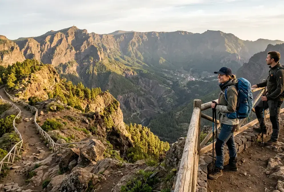
Most visitors assume Caldera de Taburiente is a volcanic crater. It isn't, not in the way Tajogaite is. The 10-kilometre-wide bowl at the island's centre was carved by water and landslides rather than a single eruption, a genuine erosion caldera, and Spain designated it a national park in 1954, one of the earliest such protections in the country, and home to the island's highest point, Roque de los Muchachos, at 2,426 metres on the caldera rim[1], its observatory campus sitting just below the true summit, at 2,396 metres.
Inside the park, the trail options split into two very different kinds of day. Pick a route that matches your evening plans rather than your ambition; a six-hour descent leaves you in no state for a midnight drive to a viewpoint.
La Cumbrecita is the version most people actually do: drive to the car park, then walk a roughly 3-kilometre loop between two lookouts, Mirador Lomo de las Chozas and Mirador de los Roques, both of which frame the caldera's cliffs without any real elevation gain. It's the right call if you're stargazing that same night and don't want tired legs.
| Trail | Difficulty | Length | Time |
|---|---|---|---|
| La Cumbrecita loop | Easy | ~3 km | 1-1.5 hours |
| Mirador de Los Brecitos | Moderate-long | 12.5 km | ~6 hours |
| Pico Bejenado | Challenging | Steep switchbacks | Half day |
| Full caldera traverse | Advanced | Full loop | Full day |
For a proper day inside the caldera, Mirador de Los Brecitos is the classic: a 12.5-kilometre descent through pine forest that takes around six hours and exits along the Barranco de las Angustias[2]. There's no scrambling and no route-finding puzzle, just distance, dry riverbed, and very little shade in the lower half. Pico Bejenado is the steeper alternative from the Cumbrecita side, a switchback climb worth attempting only if you already hike regularly, and the full caldera-loop traverse is a genuinely demanding day of elevation gain and dry barrancos best left to hikers who know their own pace.
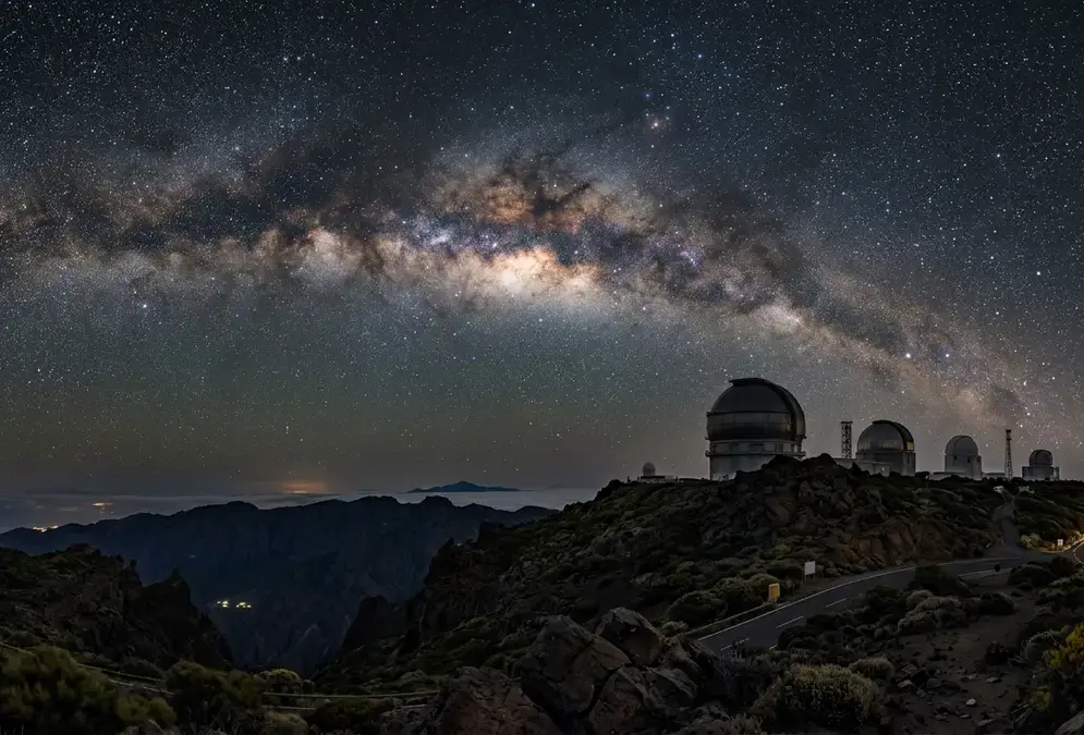
Whichever trail you skip, don't skip Roque de los Muchachos itself. It sits inside the national park boundary, and it happens to be where the astronomical observatory looks up at the same sky you'll be under after dark. Drive up in daylight for the caldera view; come back after sunset for the reason the island made this list of dark-sky destinations in the first place, and read La Palma stargazing for what that night actually looks like.
Tajogaite: walking the 2021 eruption zone, guided only
Tajogaite is the newest thing on this list by roughly half a million years. The volcano opened on 19 September 2021 on the Cumbre Vieja ridge and didn't stop until 13 December, burying whole neighbourhoods in the Aridane valley under fresh lava. The ground inside the restricted zone still vents CO2 and remains genuinely unstable underfoot, five years later[3]. That's why access stays authorized-guide-only, with no independent permits and no solo hiking, this year or any year soon.
Guided treks typically start from Llano del Jable, a stark black-sand plain at roughly 1,200 metres[11] that doubles as a stargazing meeting point after dark, and cross ash and clinker rather than technical terrain. A good guide treats the walk as sober history, not a photo op: they'll point out a church tower still rising above the flow, or the line where banana plantations gave way to black rock. Bring sturdy closed shoes and sun protection; there's almost no shade, and the ash reflects heat like a griddle.
The ground inside the restricted zone still vents CO2 and remains genuinely unstable underfoot, five years later.
If you want the pairing done properly, day tour plus an evening under La Palma's Bortle 1-2 sky, the La Palma Volcano & Stars Day tour lays out how to book both halves without wasting the gap between them.
Salinas de Fuencaliente: pink salt pans and two volcanoes
At the island's southern tip, the Salinas de Fuencaliente salt pans sit in the shadow of two volcanoes: San Antonio, dormant since 1677, and Teneguía, La Palma's most recent eruption before Tajogaite, in 1971[4]. The salt works have grown since 1967 to their current 35,000-square-metre extent, and were declared a Natural Area of Scientific Interest in 1994, a designation that followed the site surviving Teneguía's own ashfall, which had paused construction for a year in the early 1970s[4].
The colour is the first thing you notice. The shallow evaporation pans run through white, then a startling pink, the result of Dunaliella salina, a microorganism that concentrates a red pigment as the water gets saltier. The family-run operation still hand-harvests seven or eight times a year, from May to October, under the brand Sal Marina Teneguía, and the pans sit beside a working lighthouse, best visited in the morning before the light flattens.
- 1967
Salt works founded
Fuencaliente's salt pans begin operating, eventually growing to 35,000 square metres.
- 1971
Teneguía erupts
Ashfall from the nearby Teneguía volcano halts salt-pan construction for a year.
- 1994
Scientific protection
The salt pans are declared a Natural Area of Scientific Interest (LENAC 12/1994).
For a full day rather than a quick stop, the loop trail from the San Antonio Volcano Visitor Center through the Teneguía crater to the salt pans and back covers about 12.4 kilometres and 720 metres of elevation gain, roughly five to five-and-a-half hours through what feels like a lunar landscape[5]. Bring more water than you think you need; there's almost no shade on the volcanic stretch.
Los Tilos: a laurel forest older than the Sahara's dry spell
Los Tilos, in the island's northeast near Los Sauces, protects a slice of laurisilva, the laurel-forest ecosystem that once covered much of southern Europe and North Africa during the Tertiary period and now survives in only a handful of pockets worldwide, this one among the largest[6]. Trees reach 40 metres, tree ferns crowd the understorey, and the whole place is wet in a way nothing else on this list is.
The UNESCO history here gets mixed up in a lot of write-ups, so it's worth being precise. Los Tilos itself was declared a UNESCO Biosphere Reserve in 1983. In 2002, that designation was extended and renamed to cover the entire island of La Palma, with the original Los Tilos reserve becoming the new reserve's core zone[7]. The forest didn't change; the paperwork around it grew to match the whole island's dark-sky and biodiversity credentials.
Entry is free, and the visitor centre is the hub for two very different walks: the easy five-minute stroll to the 75-metre Los Tilos waterfall, and the longer Espigón Atravesado route, 6.5 kilometres along an old dirt road to a viewpoint over the Parque Natural de Las Nieves. A separate trail, the Ruta de los Nacientes de Marcos y Cordero, threads through tunnels and past natural springs deeper in the forest, for anyone who wants half a day rather than an hour.
Santa Cruz de la Palma: balconies, a Mudéjar ceiling, and a pirate-proof castle
The island capital is compact enough to cover in half a day, built around Plaza de España and the kind of colonial-era streetscape you don't expect on a volcanic island. Iglesia de El Salvador, on the square, dates to the early 16th century and hides a Mudéjar coffered ceiling behind an otherwise plain Renaissance facade[8], the kind of detail easy to miss if you don't look up.
Calle Real, the old main street, runs a few blocks back from the harbour lined with wooden balconies, a Canarian architectural signature that shows up across the archipelago but feels particularly dense here. At the harbour end, Castillo de Santa Catalina, a 16th- and 17th-century fortification, once defended the port from pirates and corsairs working the Atlantic trade routes[9]; you can walk its walls in twenty minutes and get a clean view back over the old town roofs.
Two smaller stops round out the visit: the Barco de la Virgen, a full-scale replica of Columbus's Santa María that now houses the naval museum, and the Museo Insular, the island's general museum, a few streets inland. Neither needs more than half an hour, which makes Santa Cruz an easy morning stop before an afternoon drive toward the caldera or the salt pans.
Planning a full day beyond the telescope
None of this competes with the sky; it sets up the sky. Spend the morning in the caldera or at the salt pans, eat properly in Los Llanos de Aridane or Santa Cruz, rest through the hottest hour, and you arrive at your evening stargazing session tired in the right way rather than the wrong one.
West-coast bonus, if you have a spare morning: Tazacorte, surrounded almost entirely by banana plantations, is home to the tiny Museo del Plátano, reportedly the only museum in Europe dedicated to the crop, for around two euros[10]. A handful of local operators run walking tours through working plantations nearby in Los Llanos de Aridane; schedules vary through the year, so treat any specific day or time you find online as provisional and confirm locally rather than planning around it.
Recommended tours
Tours are selected for quality, not commission. I earn a small fee if you book — at no extra cost to you.



How many days does this actually take? One full day covers either the caldera or Tajogaite plus the salt pans, comfortably. Two days lets you add Los Tilos and Santa Cruz without rushing either. If you're already committed to the island's night skies for the main event, book at least one of these into your itinerary before you decide the island is only about looking up.
Featured · Destination
La Palma Stargazing
La Palma stargazing guide: the world's first Starlight Reserve since 2012, Bortle 1-2 skies above Roque de los Muchachos, plus where to stay and go year-round.
Whichever combination you pick, a rental car is not optional. Public transport barely reaches Garafía or the salt pans, and the drive between the north's laurel forest and the south's volcanoes is the better part of two hours on switchback roads. Fuel up on the coast; stations thin out fast once you climb. Check the La Palma Stargazing Tour or the La Palma Astrophotography Tour listings before you land, since evening slots around a new moon sell out first.