
The Andes wall: blocking rain from the east
The Atacama sits on the western slope of the Andes, between the Pacific Ocean and the world's second-highest mountain range. From the east, moisture-laden air from the Amazon basin and the Atlantic tries to move westward. It runs into the Andes, which reach 6,000 metres and higher along the central Chile-Bolivia border.
As air rises over a mountain barrier, it cools. Cooler air holds less moisture, so it rains — heavily — on the eastern slope. By the time that air crests the Andes and begins to descend on the western side toward the Atacama, it has already shed most of its water vapor. Descending air also compresses and warms adiabatically, which makes it even less likely to produce rain. This is the classic rain shadow effect: the windward side gets the precipitation; the leeward side gets the dry air.
The result is not marginal dryness. The Atacama plateau receives less than 1 millimetre of rainfall per year on average in many areas. The driest sectors, around the town of Arica at the northern end of the desert, hold the record for the longest rainless stretch of any inhabited place on Earth[1]. San Pedro de Atacama at 2,443 m (8,015 ft) sits somewhat wetter than the most extreme sectors but still measures precipitation in the single-digit millimetres annually, with months that register zero.
For a stargazer, the practical implication of the Andes barrier is that the wet seasons that affect neighbouring Bolivia — the so-called altiplanic winter in January and February, when Atlantic moisture crosses the Andes as convective thunderstorms — represent the only meaningful cloud risk at San Pedro. For the other ten months, the Andes wall does its job.
The Humboldt Current: why cold ocean blocks Pacific rain
The second system operates from the opposite direction. A naive assumption might be: the Atacama is coastal, it should get moisture from the Pacific. The Humboldt Current is why it does not.
The Humboldt is a cold-water upwelling that runs northward along the western coast of South America, driven by the rotation of the Earth and the prevailing trade winds. Cold water at the ocean surface chills the air directly above it. Chilled air cannot hold much moisture, and more importantly, it cannot rise. Without rising air, there is no mechanism to form the cumulonimbus clouds that produce rain. The marine air sits in a stable thermal inversion: a layer of cool, moist air trapped beneath warmer air above, unable to convect upward.
What this inversion does produce is coastal fog — the camanchaca — which drifts inland in the mornings along the Chilean coast. At lower elevations near the ocean, cacti and fog-collecting plants depend on it. But the camanchaca rarely penetrates the interior plateau where San Pedro sits. By the time it reaches 2,000 metres or higher, it dissipates. The desert gets neither the Pacific rain nor the Atlantic rain.
The Humboldt Current also plays a secondary role in keeping the desert cool enough to retain its aridity. Coastal temperatures along northern Chile run 10–15°C lower than comparable latitudes on west-facing coasts elsewhere would suggest. This suppresses the convective heating that might otherwise drive inland moisture movement from the ocean.
The subtropical high-pressure zone: the third lock
Even if the Andes barrier weakened and the Humboldt Current warmed, a third atmospheric system would still prevent rain: the South Pacific Subtropical High, also called the South Pacific Anticyclone.
At roughly 20–35°S latitude, air that rose near the equator in the Hadley Cell circulation descends back toward the surface. Descending air creates high pressure. High-pressure systems suppress cloud formation because the descending air warms as it compresses, reducing relative humidity and stabilising the atmosphere. The same mechanism drives the world's other great deserts — the Sahara sits under the North African subtropical high, the Australian Outback under the Southern Hemisphere equivalent.
San Pedro de Atacama sits at approximately 22.9°S, squarely inside the subtropical subsidence belt. The South Pacific High is not a seasonal visitor; it is a semi-permanent feature of Southern Hemisphere atmospheric circulation. During Southern Hemisphere winter (June–August), it shifts slightly northward and intensifies, which is precisely when Atacama skies reach their best quality. Atmospheric scientists describe this as the dominant driver of the Atacama's year-round aridity: even without mountains or cold ocean currents, this latitude would be relatively dry.
For the Atacama, all three systems work simultaneously. No other desert on Earth has this exact combination stacked together at this scale. The Sahara is large but lacks a cold-water upwelling system on its western coast. The Namib shares the cold-current dynamic (the Benguela Current) but not the same altitude or rain-shadow geometry. The Atacama's dryness is overdetermined.
What extreme dryness actually measures
The effects of these three systems show up in numbers that are genuinely difficult to grasp. Parts of the Atacama plateau have gone years without a single measurable rainfall event[1]. The 50-year average annual rainfall for the interior desert is less than 15 mm, and in the driest central sectors it falls below 2 mm. For context, London receives around 600 mm per year.
At San Pedro de Atacama, the driest months run from approximately May through October, when monthly precipitation rounds to zero[2]. February is the wettest month with a long-term average of roughly 29 mm — still barely a rainy month by any temperate-climate standard, though enough to produce afternoon thunderstorms during the Bolivian winter.
330+
The second quantity that matters for astronomy is atmospheric water vapour, measured as precipitable water vapour (PWV) in millimetres of equivalent liquid column. High PWV scatters visible light and absorbs infrared wavelengths, degrading telescopic images. At San Pedro and the surrounding plateau, PWV regularly drops below 2–3 mm during June–August, exceptional transparency by global standards. Coastal European observatories in comparison often operate at PWV values of 10–20 mm.
Temperature extremes compound the dryness. The diurnal swing at San Pedro routinely runs 15–20°C between afternoon and pre-dawn: up to 24°C in January afternoons, near-freezing at the same elevation in June before sunrise. Dry air holds less heat than humid air, so the desert radiates its warmth rapidly after sunset, cooling the ground faster than the stratosphere. This thermal stability at night reduces atmospheric turbulence, which means steadier, sharper telescope images.
Why the world's best telescopes are here
The connection between the Atacama's dryness and its suitability for astronomy is not coincidental. The European Southern Observatory chose the broader Atacama region for its flagship instruments because no other accessible site on Earth offers the same combination of atmospheric qualities.
ESO's Very Large Telescope (VLT) at Paranal, 130 km south of Antofagasta, sits at 2,635 m[4] on a ridge that ESO's site-testing teams identified as one of the best seeing sites in the Southern Hemisphere. The seeing — a measure of atmospheric turbulence that determines how sharp a telescope's images can be — averages below 0.8 arcseconds at Paranal, exceptional for a ground-based instrument.
Featured · Destination
Atacama Desert Stargazing
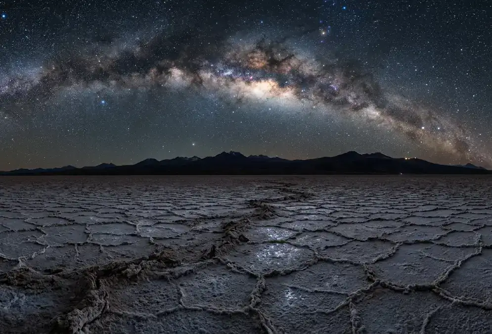
Earth's driest desert delivers Bortle 1–2 skies, 330+ clear nights a year, and the galactic core almost overhead. Guide: tours, lodges, season, getting there.
Higher on the plateau, the Atacama Large Millimeter/submillimeter Array (ALMA) operates at approximately 5,000 m[3], at a site chosen specifically because millimetre-wave radio observations are almost entirely blocked by atmospheric water vapour at lower altitudes. ALMA's antennas need an atmosphere so dry that liquid water is essentially absent, which describes the Atacama altiplano on almost any given night. Public visits to ALMA are currently suspended as of 2026-06-30, though the ESO Paranal site remains open for Saturday visitor tours.
Recommended tours
Tours are selected for quality, not commission. I earn a small fee if you book — at no extra cost to you.
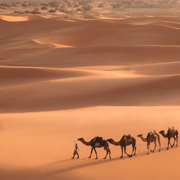
For a traveller with binoculars and no telescope at all, the same physics applies at smaller scale. Water vapour scatters the short blue wavelengths of starlight, reducing the contrast of faint objects against the sky background. At Bortle class 1–2 conditions around San Pedro de Atacama, the naked-eye limiting magnitude reaches an estimated 7.5–8.0[1] under new-moon conditions, roughly two magnitudes deeper than a typical dark rural site in Europe. The difference between Bortle 3 and Bortle 1 is the Milky Way looking like a bright feature versus looking like structural detail: dust lanes, star-forming regions, the distinct bulge of the galactic core.
The Atacama's dryness also enables something specifically Southern-Hemisphere remarkable. From approximately 22.9°S latitude, the galactic core in Sagittarius transits near the zenith during June and July. That high transit angle means the galactic centre passes through a shorter column of atmosphere than it does from a northern-hemisphere site — less turbulence, less extinction, better images. Add sub-5% humidity and you have conditions that professional astronomers spend careers chasing.
What the dryness means for your stargazing trip
Understanding the atmospheric mechanics has practical value when you plan your visit. The dryness is not uniform across the year, and the one window when it relaxes (the Bolivian winter) is the only real scheduling risk.
May through October is when all three systems operate at their strongest simultaneously. The South Pacific High intensifies, the Andes block any remaining Atlantic convection, and the Humboldt Current keeps Pacific moisture offshore. Monthly precipitation drops to below 1 mm; the pre-dawn temperature regularly falls to near-freezing or below. For visual stargazing and astrophotography, this is the premier window. The galactic core also happens to be highest in the sky during June–July. That is not a coincidence; it is winter when these latitudes offer the longest useful dark windows.
January and February carry weather risk. Atlantic moisture pushes across the Andes as altiplanic winter thunderstorms, most common in the afternoons and evenings. Mornings often remain clear even in these months, and some years the Bolivian winter barely materialises. The risk is real enough to factor into planning but not large enough to make the shoulder-season useless. See best time for Atacama stargazing for the month-by-month breakdown.
The dryness also affects your body in ways unrelated to astronomy. At 2,443 m in air with near-zero humidity, you dehydrate faster than you expect. The respiratory moisture loss alone is significant at altitude and in ultra-dry air. Budget 3–4 litres of water per day from arrival, and treat headaches on Day 1 as altitude and dehydration until proven otherwise before assuming something more serious.
For equipment: batteries drain faster in cold, dry conditions. A red-light headlamp is essential for preserving your dark adaptation during a session, since white light destroys 20–30 minutes of adjustment in seconds. Carry a warm insulated layer even in September, when afternoons feel mild. A guided astronomy tour provides both equipment and expert pointing, which makes far more practical sense than hauling a telescope from overseas when the observatories here run 12- to 16-inch instruments with laser pointers and expert narration.