
Four Named Spots, One Gold-Tier Sky
Death Valley holds Gold Tier certification from DarkSky International, the highest rating on a three-tier scale[1], and the park's own rangers are specific about where that darkness actually pays off. The National Park Service names Zabriskie Point, Mesquite Flat Sand Dunes, and Harmony Borax Works as the spots astrophotographers reach for most often[2]. Add Badwater Basin, the park's most photographed feature by day and one of its best after dark, and that's four places worth knowing before you pick a direction to drive.
Plan around the heat before you plan around the sky. Daytime highs here routinely reach at least 120°F at the low desert elevations in summer[3], hot enough that the smart move is scouting a spot in daylight and returning after sunset, not wandering unfamiliar ground at 2 p.m. looking for a good angle.
All four sit within a short drive of Furnace Creek, the park's small hub and the obvious base for a night of spot-hopping. None require a permit, a reservation, or gear beyond a red-light headlamp and real layers once the sun goes down. What separates them is what each one actually shows you, a flat horizon, an elevated overlook, or textured dunes, and how far you're willing to drive to reach it before the light goes. Stargazing in Death Valley covers the park's Gold Tier designation and ranger programs in full; this guide is about which patch of that certified darkness to stand under.
Badwater Basin: The Flattest Horizon in the Park
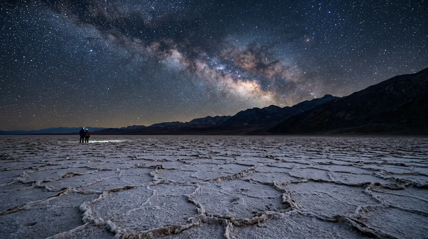
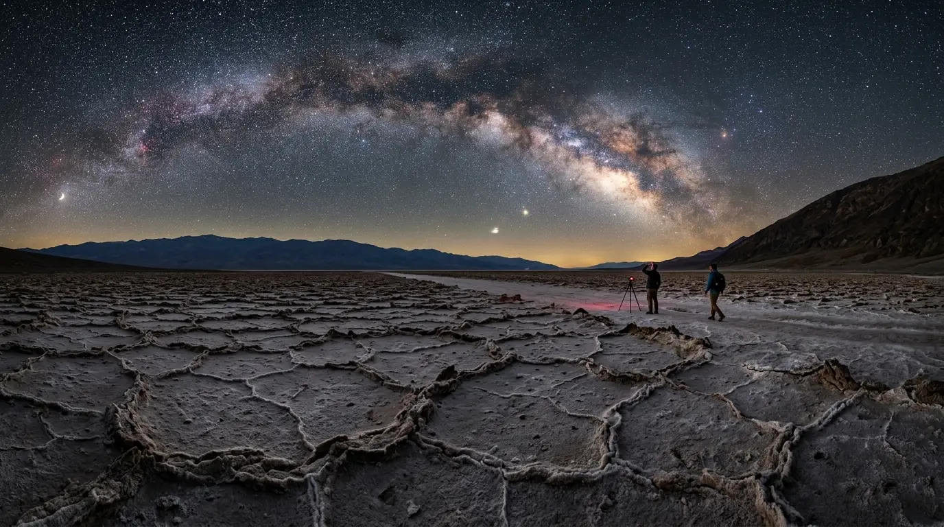
Badwater Basin sits 282 feet below sea level, the lowest point in North America, and reads as genuinely black overhead despite being one of the park's busiest daytime stops. The salt crust underfoot holds the day's heat well into the evening, but the flat pan itself is the whole point, an unbroken foreground with nothing to interrupt the horizon line.
It's also the easiest of the four to reach: 17 miles south of Furnace Creek on Badwater Road, mostly flat driving followed by a walk across salt flats rather than a scramble up anything[4]. No uphill hiking and no trail-finding in the dark, just parking and walking out onto the pan until the lights of the lot fall away behind you.
The salt crust underfoot holds the day's heat well into the evening, but the flat pan itself is the whole point, an unbroken foreground with nothing to interrupt the horizon line.
The trade-off is horizon. Badwater's basin walls sit close enough that they cut into the sky at a low angle in every direction, so anything rising or setting near the horizon gets clipped early. For an unobstructed 360-degree sky, the dunes below handle that job better.
Zabriskie Point: The Overlook Astrophotographers Choose
Zabriskie Point is the closest of the four to Furnace Creek, 5 miles from the visitor center, and the easiest to fold into a normal evening: dinner, a short drive, and a viewing area waiting at the top with no path-finding required in the dark. By day it's a golden-hour postcard, the badlands below carved into rounded, multi-hued ridges. After dark, that same relief becomes foreground, giving astrophotographers something with real shape and shadow to frame under the sky instead of flat desert.
That's exactly why the National Park Service lists it among the spots astrophotographers reach for most, alongside Mesquite Flat and Harmony Borax Works. The flat overlook means a tripod sits level without improvising, and the short walk from the parking area makes this the most forgiving of the four for a first night out, or for a group that isn't all equally steady on uneven ground after dark.
Featured · Destination
Death Valley
Death Valley's Gold-tier dark sky sits at the lowest point in North America. Here's when to visit, where to stay, and how to handle the extreme summer heat.
Elevation here isn't dramatic, but the overlook's height above the badlands adds just enough separation from the valley floor to cut some of the heat shimmer that can blur long exposures lower down on hot nights.
Best time to arrive
Get here with at least twenty minutes of daylight left on a first visit. The platform is easy to find in the dark once you know it, but scouting the exact rail you want to shoot from, and where the parking lot actually ends, is a lot easier before the light goes.
Mesquite Flat Sand Dunes: Texture Near Stovepipe Wells
Trade Badwater's salt for sand at Mesquite Flat, near Stovepipe Wells, where the dunes provide an unobstructed, 360-degree stretch of sky with none of Badwater's low horizon walls in the way. You can recline right on the sand instead of standing on hard-packed ground, which matters more than it sounds like it should after an hour of looking straight up.
Full moon nights do something here that they don't at the other three spots: they turn what's normally a photography liability, a bright moon washing out faint stars, into its own kind of shot. If a genuinely dark sky is the goal rather than a moonlit landscape, plan around the new moon instead; the best time to stargaze in Death Valley breaks down exactly which nights of the month work best here.
Featured · Article
What Is Astrotourism? The Complete Beginner's Guide
Astrotourism means travel built around dark skies: meteor showers, auroras, the Milky Way. What it means, where to go, and how to plan your first trip.
Recommended tours
Tours are selected for quality, not commission. I earn a small fee if you book — at no extra cost to you.
Stovepipe Wells is also the most convenient base for this particular spot. The Stovepipe Wells Village Hotel puts you a short drive from the dunes rather than the longer haul back from Furnace Creek, which matters more at midnight than it does at dinner.
One practical note
Stick to open sand and avoid the scattered vegetation at the dune field's edges after dark. It's easy to miss in low light, and it's where the local wildlife tends to gather.
Ubehebe Crater and the Park's Far Corners
Drive north and the park changes register. Ubehebe Crater, well north of Furnace Creek in the northern half of Death Valley, holds some of the darkest and most photogenic skies anywhere in the park[5], a wide volcanic crater with a rim trail that puts a genuinely dramatic foreground under the stars instead of flat desert. It's the longest drive of the four spots covered here, and that distance is exactly why the sky over it runs darker than anything closer to Furnace Creek's scattered lights.
Harmony Borax Works, near Furnace Creek itself, is worth knowing as a fifth option even though it isn't one of the four primary spots above: the National Park Service recommends it directly for night sky viewing and astrophotography, vehicle-accessible with no hike required[6], and Mustard Canyon Road nearby offers a slightly more isolated pull-out for anyone who wants distance from the historic site's own parking area.
Two spots that deserve a mention, not a detour
Racetrack Playa, home to the park's famous sailing stones, sits deep in the park's remote backcountry, far from any light source, but reaching it means a rough gravel road that demands a high-clearance 4x4, no cell coverage, and a full tank before pavement ends, a serious undertaking best planned as its own trip rather than a fifth stop tacked onto a night that already covers three others. See Racetrack Playa's sailing stones under the night sky for the camping-vs-day-trip logistics and night-photography approach that trip actually needs. Dante's View, a further-flung overlook south of Furnace Creek, is the sixth option if you have an extra hour and want elevation over any of the valley-floor spots.
Getting There Safely: Heat, Water, and the Drive Back
None of this is worth much if the drive back goes wrong. Potable water in Death Valley is sold at exactly three places, Furnace Creek, Stovepipe Wells, and Panamint Springs, and the National Park Service's own guidance is to carry a minimum of one gallon of water per person per day, doubled if you're doing anything strenuous like the walk out to Ubehebe's rim[7]. Fill up before you leave whichever of those three towns you're staying in, not after.
Nighttime doesn't cancel the heat the way it does in most deserts. Overnight lows in summer can still sit above 100°F[8], warm enough that a flashlight, a full water bottle, and a phone with offline maps downloaded aren't optional extras. They're the baseline for a safe night out here, at any of the four spots above.
Four spots, one certified dark sky, and the real decision is how far you're willing to drive for it: five minutes to Zabriskie Point, seventeen miles of flat road to Badwater, a short haul through Stovepipe Wells to the dunes, or the longest of the four drives north to Ubehebe's rim. Carry water either way. For a full comparison of where to actually stay near each of these spots, see the ranked guide to Death Valley's stargazing lodges.
| Spot | Distance from Furnace Creek | Best for |
|---|---|---|
| Badwater Basin | 17 miles south | Flattest horizon, easiest access |
| Zabriskie Point | 5 miles | Quickest after-dinner drive |
| Mesquite Flat Dunes | Near Stovepipe Wells | Dune texture, full-moon photography |
| Ubehebe Crater | Longest drive of the four, well north of Furnace Creek | Darkest sky of the four |
What to carry, and when to fill up
- Fill up on water at Furnace Creek, Stovepipe Wells, or Panamint Springs before you leave for the night, not on the way back
- Let your eyes adjust fully to the dark before judging how good the sky actually looks; a bright phone screen resets the process instantly
- Check your vehicle, tires, coolant, a full tank, before a night that includes Ubehebe Crater or Racetrack Playa specifically, since services thin out fast north of Furnace Creek
- Tell someone your route if you're heading beyond Zabriskie Point or Badwater Basin after dark