
The blue hole over Abisko: a folk name for a real phenomenon

Ask an aurora guide in Abisko what they are actually watching for on a half-cloudy night, and most will point straight up rather than out toward the horizon. What they are looking for is a gap directly overhead that local guides call the blue hole: moist weather systems arriving off the Norwegian coast lose their cloud cover on the border peaks, then descend dry into the Torneträsk basin as a patch of clear sky roughly 10-20 square kilometres wide, sitting with striking consistency right over Abisko National Park[1].
'Blue hole' is a name coined by tour operators and aurora guides, not a term from the meteorological literature, and the distinction matters. The visible clear patch is the effect. The cause is a well-established, unremarkable-by-meteorological-standards process called a rain shadow (or precipitation shadow), and Sweden's own weather authority names this exact village as its textbook case. The rest of this piece works through that mechanism directly, not the marketing version of it.
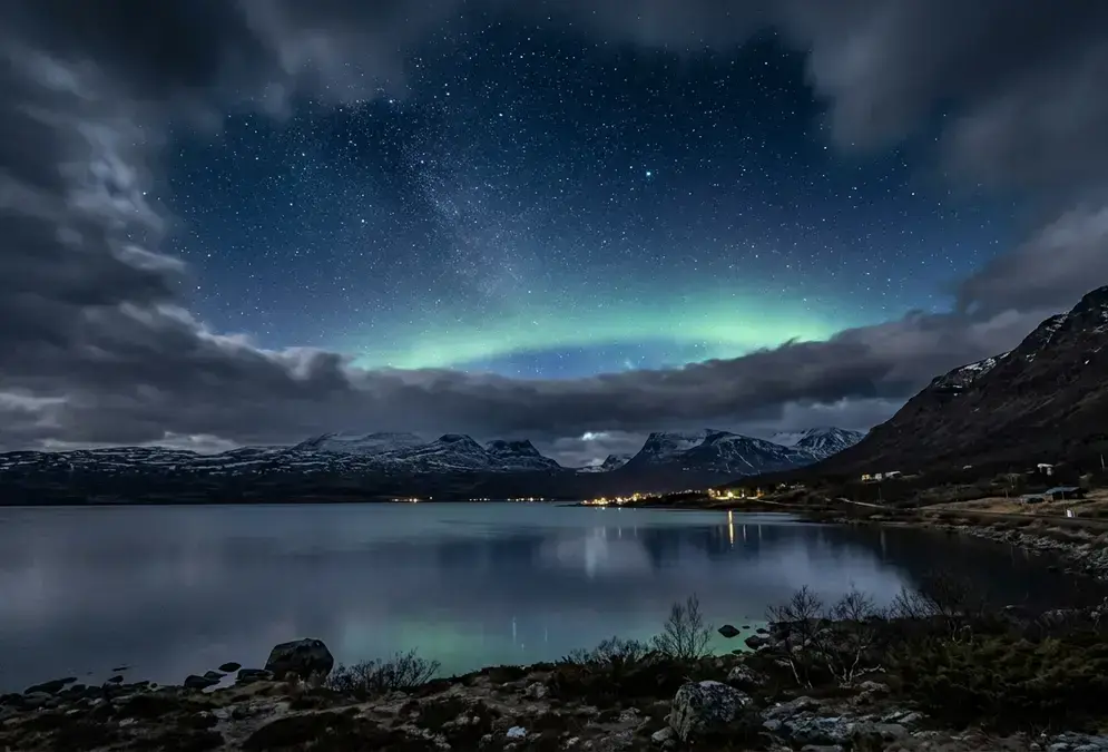
Clear, star-filled sky over Abisko National Park and Lake Torneträsk in Swedish Lapland, with cloud visible along the distant horizon, illustrating the clear-sky microclimate explained by Abisko's rain shadow.

Clear, star-filled sky over Abisko National Park and Lake Torneträsk in Swedish Lapland, with cloud visible along the distant horizon, illustrating the clear-sky microclimate explained by Abisko's rain shadow.

That specificity is also why local guides do not just check a general Lapland or Kiruna forecast before heading out for the night. The blue hole is a local event, confined to a fairly small patch of sky, not a regional one, so the difference between a clear night and a cancelled one often comes down to conditions immediately over Abisko rather than the wider forecast for the rest of Swedish Lapland.

How a rain shadow works: orographic lift, no folklore required

A rain shadow needs three things working together:

  • a mountain range set across the prevailing wind
  • moisture-laden air riding that wind off open water
  • a clear windward/leeward split, so one side faces the wind and the other sits sheltered from it
Moist air forced upward on the windward slope cools as it rises, a process called orographic lift. Cooler air holds less moisture, so the excess condenses out as cloud and precipitation dumped on that windward side. By the time the same air crests the range and starts descending the leeward slope, it has already shed most of its water; descending air warms back up, and what little cloud remains burns off. Storm systems arriving off the North Atlantic travel broadly eastward into Scandinavia, which is why a mountain range running roughly north to south along the Norway-Sweden border intercepts nearly every wet system before it can reach the Swedish side.
SMHI, Sweden's meteorological and hydrological institute, uses exactly this process to explain the sharp climate divide across the Scandinavian Mountains: the range along the Norway-Sweden border catches the moist westerlies blowing in off the North Atlantic, so western Norway and the westernmost peaks of Swedish Lapland see heavy rain and snow, while the area east of that same range gets comparatively little. The contrast is measurable at close range too: Riksgränsen, a ski resort only about 30 kilometres further west but still on the wetter, windward side of the same peaks, receives roughly three times Abisko's annual rainfall[2]. The same physics parches deserts a world away: why the Atacama Desert is the driest place on Earth walks through an almost identical rain-shadow story, just cast by the Andes instead of the Scandinavian Mountains.

Why Abisko sits in the driest slice of that shadow

Abisko sits squarely on the leeward side of that range, sheltered from the worst of the Atlantic weather before it reaches Swedish Lapland's interior. SMHI names the village directly as Sweden's most precipitation-poor location, averaging roughly 300 millimetres of rain and snow a year[2].
Wikipedia's own account of the village agrees from an independent angle: Abisko is 'a very cloudy village by Swedish standards' that still ranks among the driest places in the country because of this same rain shadow, and its closest comparison point makes the scale obvious: Abisko receives less than half of nearby Riksgränsen's precipitation despite the short distance between the two[3].

~300mm/yr

Abisko's average annual precipitation, per SMHI: the lowest of any location in Sweden. Riksgränsen, a ski resort on the same mountain range, sees roughly three times as much rain and snow each year.

A hundred-year weather record, not a single measurement

None of this rests on a single lucky measurement. The Abisko Scientific Research Station, a field station now run by the Swedish Polar Research Secretariat, has recorded air pressure, temperature, humidity, wind, and precipitation continuously since 1913, after an earlier station at nearby Katterjokk burned down in 1910, and in June 2021 that unbroken record earned Abisko a place among the World Meteorological Organization's Centennial Observing Stations, a designation reserved for sites with at least a hundred years of continuous data[4].
That is not the same institution as the Swedish Institute of Space Physics (IRF) up the road in Kiruna, which studies aurora and space-weather physics rather than rainfall, a mix-up common enough in casual write-ups that it is worth stating plainly. The research station sits inside Abisko National Park, close enough to STF Abisko Turiststation and the Aurora Sky Station chairlift that guests staying there are, without realizing it, sleeping inside the same instrumented microclimate the station has tracked for more than a century. A century-plus record matters for a claim like this one specifically because it rules out a lucky run of years: a decade of low rainfall could be coincidence, but more than a hundred years of consistent, unbroken readings is the kind of evidence that survives scrutiny rather than just repetition.
Timeline
  1. 1910

    Katterjokk station destroyed by fire

    An earlier meteorological station at Katterjokk, west of Abisko, burns down.

  2. 1913

    Continuous recording begins at Abisko

    A new station opens and starts the unbroken run of pressure, temperature, humidity, wind, and precipitation readings still running today.

  3. 2021

    Named a WMO Centennial Observing Station

    The World Meteorological Organization recognizes the station's century-plus, uninterrupted data record.

Why the microclimate matters more for aurora chasing than for weather trivia
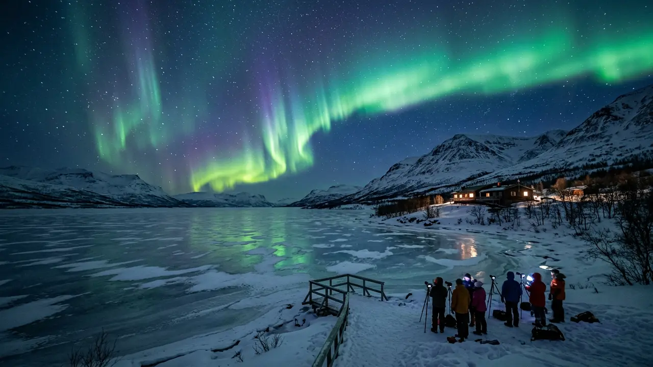
None of this would matter to a stargazing trip if clear sky were not the actual bottleneck. Under an active auroral oval, the limiting factor for actually seeing the northern lights is almost never whether the aurora is happening. It is whether the sky above the viewer is clear enough to show it[5], the variable meteorologists sometimes call clear-sky fraction, and it is exactly the variable a rain shadow improves and a coastal microclimate usually cannot. A strong geomagnetic storm directly overhead is invisible through a solid layer of cloud, while a comparatively minor one under a genuinely clear sky can still be the best display of a trip; the sky, not the storm, is usually the deciding factor most travellers underrate.
That is the real distinction between Abisko and a coastal base like Tromsø: both sit under a broadly similar stretch of the auroral oval, so geomagnetic activity on a given night tells roughly the same story either place. What differs is how often the sky above each town actually cooperates. Abisko vs Tromsø for stargazing works through that full comparison, flights and trip length included; this piece only needed to establish why the sky itself behaves differently.

Featured · Destination

Abisko Stargazing

Abisko's rain-shadow microclimate keeps skies clear when nearby Arctic spots cloud over. Aurora season, the Sky Station, ICEHOTEL, and getting there by train.

What the blue hole actually promises, and the one number to ignore

None of this makes Abisko a guaranteed clear sky. A rain shadow shifts the odds; it does not cancel Arctic weather outright. Shut-out weeks still happen, and the blue hole itself can drift, tighten, or briefly close under a strong enough system pushing through the mountains.
One specific claim is worth flagging directly. You will see it repeated across aurora blogs and tour-operator copy: that Abisko gets clear skies on roughly twice as many winter nights as Tromsø, 90 kilometres up the coast. Treat that particular multiple with real skepticism. It shows up everywhere and traces back to no single dataset we could verify. What is actually documented, and stands on its own without a manufactured ratio, is the rain shadow itself and more than a century of SMHI and Abisko Scientific Research Station data behind it. That is reason enough to plan around, without inventing a number nobody has actually measured.

For trip planning, that translates into three concrete moves:

  • Build in enough nights that the rain shadow gets a fair chance to work. Best time to stargaze in Abisko covers the season and the equinox weeks worth prioritizing.
  • Do not fixate on any unverified clear-night ratio; plan around the documented mechanism instead.
  • Check a short-range, local forecast rather than a regional one, since the clear patch is not uniform across the whole national park. Best stargazing spots in Abisko compares the named viewing points that sit most reliably inside it.