
A Clear Forecast Doesn't Mean a Clear Sky From Downtown
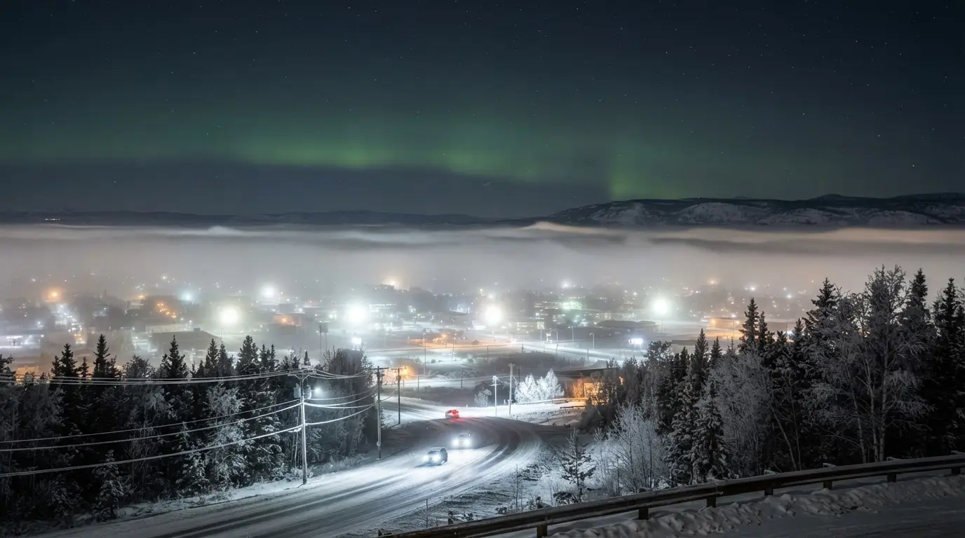
Checking the UAF Geophysical Institute forecast the way our Fairbanks aurora forecast guide walks through it, Kp reads 3, the cloud overlay shows mostly clear, and you still see nothing from a downtown Fairbanks parking lot. That is not a broken forecast. To see any aurora at all, the sky must be genuinely clear and free of clouds[4], and NOAA's cloud layer is often telling the truth about the sky several hundred feet up, not the sky at street level.
The gap between those two skies is ice fog, a shallow, ground-hugging haze specific to interior Alaska's extreme cold and near-zero winter wind. It has nothing to do with the Kp index and nothing to do with cloud cover in the meteorological sense the forecast tracks. It forms independently and low to the ground, and it can seal off the entire sky from the valley floor while a real aurora storm dances overhead a short drive away. Locals sometimes talk about 'ice fog season' as a separate thing from 'aurora season,' because the two track completely different variables: solar wind for one, still cold air for the other.
Featured · Destination
Fairbanks Northern Lights
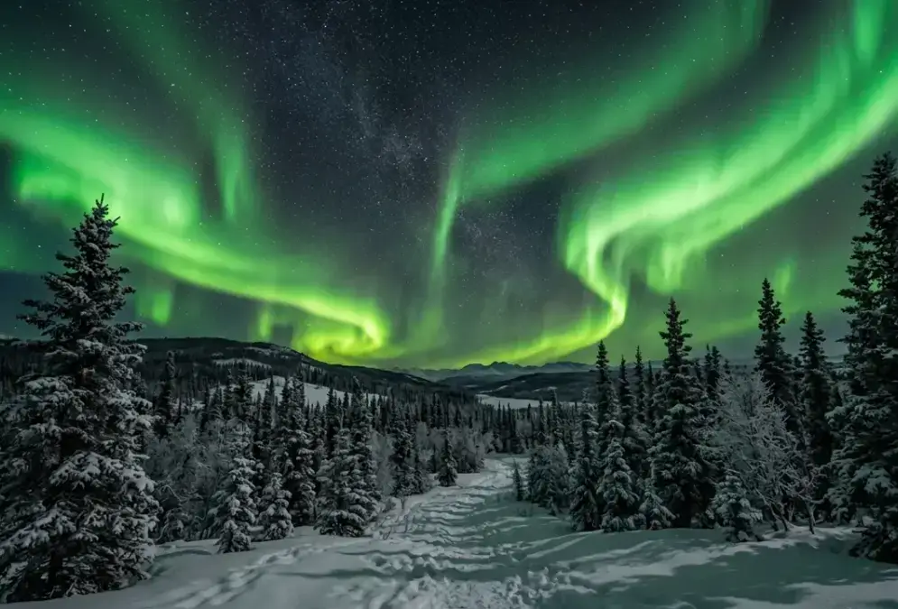
Fairbanks sits directly under the auroral oval at 64.8°N. Aurora season runs Aug 21–Apr 21, peaking Feb–Mar, with roughly 90% odds if you stay 3+ nights.
No single advisory spells out why in those exact words, but the mechanism is well documented: a locally clear forecast and a genuinely socked-in valley floor are not a contradiction in Fairbanks. They are the normal winter pattern, and understanding it is more useful than refreshing the forecast app one more time.
What Ice Fog Actually Is, and Why -30°F Is the Threshold
Ordinary fog is liquid water droplets suspended in the air. Ice fog is tiny ice crystals, and it needs air far colder than any liquid fog to form. -30°F is ice fog's magic number in interior Alaska: it does not form until the air gets that cold, and it dissipates once the temperature rises back above that line[1]. Below the threshold, almost any source of water vapor in the air, breath, a running engine, an open patch of river, can freeze directly into a haze of ice crystals that settles at ground level, trapped by the same stagnant air[8].
1.3x
The exact threshold shifts with how much water vapor is already in the air, which is why -30°F isn't a hard line everywhere in the region. In clean, rural air, ice fog may hold off until roughly -40°C (about -40°F); in dirtier air, closer to a city's exhaust and heating plumes, it can start forming as warm as -20°C (about -4°F)[5]. Fairbanks' own valley air sits closer to the dirty end of that range, thick with vehicle and power-plant moisture, which is part of why the city's ice fog forms a little sooner and lingers a little longer than the clean-air number alone would predict.
Where the moisture comes from
Two sources do most of the work. A car engine burning gasoline ejects roughly 1.3 times the mass of water vapor as the mass of fuel it burns[6], which is why a line of idling trucks at a pullout can fog itself in on a cold night. The less obvious source is an open stretch of the Chena River, kept ice-free through winter by warm water discharged from power-plant cooling systems. Today, it's a major contributor of the water vapor that becomes ice fog[7].
Ice fog isn't only a sky problem. It rimes camera gear with frost and can fog a lens the moment you step from a warm car into sub -30°F haze, one more reason cold-weather astrophotography trips need real gear planning; see the Fairbanks winter packing list for what actually holds up at these temperatures.
The Inversion That Splits Fairbanks Into Two Climates
Normally, air cools as you climb. Interior Alaska routinely runs that backwards. On calm, clear winter nights, the coldest, densest air sinks and pools in the Tanana Valley, where Fairbanks sits, while warmer air stays trapped above it in a temperature inversion. Ringed by hills that block what little wind there is, Fairbanks' near-ground inversions rank among the most extreme anywhere in the world, gaining as much as 16°F for every 100 feet of altitude[2]. The air can get so stagnant that inversions of at least some degree occur roughly 240 days a year[8], deep cold or not.
The clearest documented case comes from the Steese Highway. Driving over Cleary Summit, a National Weather Service employee watched his thermometer read 44 degrees Fahrenheit at the summit, then -2 degrees at Chatanika Lodge[9], a drop from about 2,200 feet on the hilltop to 713 feet at the valley bottom, over roughly seven miles[3]. His colleague, Ron Stuvek, found an even sharper split on the nearby Elliott Highway the next day: 40°F above zero at Wickersham Dome against 8°F below zero at the Chatanika River[10]. Eric Stevens, working in the National Weather Service office in Fairbanks that day, put it plainly[11].
The National Weather Service's own guidance on Fairbanks winters puts an upper bound on how extreme this gets: up to 55°F between the surface and the top of the inversion layer[12], with the sharpest change usually packed below 1,500 feet above sea level, meaning, since Fairbanks itself sits around 450 feet up, roughly the lowest 1,050 feet above the valley floor. That same guidance draws a line worth remembering before trusting a clear Kp forecast: 'Deep Cold/Ice Fog' is not the same as a 'Strong Inversion'[13]. A forecast can be entirely honest about geomagnetic activity and cloud cover at altitude while ice fog, an independent, ground-level event, still blanks the view from town. That's the whole problem in one line: the forecast can be right and the view from downtown can still be wrong.
Ice fog compounds its own effect once it thickens. When a dense layer settles in, the fog itself becomes the surface that radiates heat away overnight, and the coldest point of the inversion migrates up to the top of the fog dome instead of sitting at ground level, deepening the cold trapped underneath it. A home just 50 to 100 feet above the valley floor once ran 10°F to 20°F warmer than downtown on a cold night[17]; only residents in the higher hills still get that advantage now[18].
Getting Above the Fog: Where Fairbanks Chasers Actually Drive
Elevation is the fix, and Fairbanks aurora chasers already know it. Murphy Dome, one of the highest accessible points near the city, at over 2,800 feet[14], and Cleary Summit, lower but paved and reliable, both sit above where ice fog typically pools on the valley floor. Neither spot requires a permit or a tour booking. They're a drive on public roads, the same roads locals use every clear winter night.
Don't judge the whole sky by your hotel window
Ice fog forms and clears locally, and the drive out of town gets worse before it gets better: expect reduced visibility and black ice on the first few miles even on a night when the sky above Cleary Summit is genuinely clear. Slow down, and don't assume a foggy in-town view means a clouded-out night.
Our full ranked list of aurora viewing spots near Fairbanks breaks down drive times, road conditions, and which pullouts still hold a cell signal, since those two named spots aren't the only options. If winter driving on ice and gravel isn't something you want to figure out on the fly, a guided aurora viewing tour puts someone behind the wheel who already knows which direction tonight's clear patch is in, ice fog included. Either way, give yourself extra time: 20 to 40 minutes each way, driven slower than daylight speed, with no guarantee of a cell signal on the last few miles.
Is Fairbanks Ice Fog Getting Rarer, and What That Means for Your Trip
Ice fog is measurably less common than it used to be. Researcher Lea Hartl found that Fairbanks averaged more than two weeks of ice-fog days a year from 1950 to 1980[15]; examining the 30 years from 1990 to 2020, she found it down to roughly six days a year, on average[16]. Milder winters get most of the credit, specifically fewer days dropping below -30°F.
Featured · Article
What Causes the Northern Lights? The Science Explained
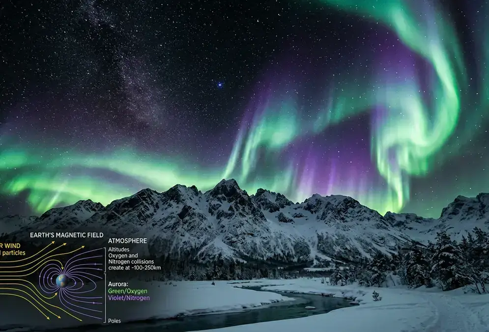
Solar wind collides with Earth's magnetic field, funneling charged particles toward the poles, where they excite oxygen and nitrogen into glowing color.
That doesn't mean the risk is gone. A single sharp cold snap can still deliver a multi-day ice fog spell even in a below-average year, so treat the decline as a trend, not a guarantee for your specific week. I'd treat any night forecast below -30°F as a plan to drive, not a coin flip worth checking from a hotel parking lot.
Check the temperature, not just the Kp forecast, before you write off a clear night. Below about -30°F, budget the extra drive to elevation. Above it, the in-town view is probably telling you the truth. For the fuller picture of which months pair the clearest skies with the best odds, when to see the northern lights in Fairbanks covers the season month by month.