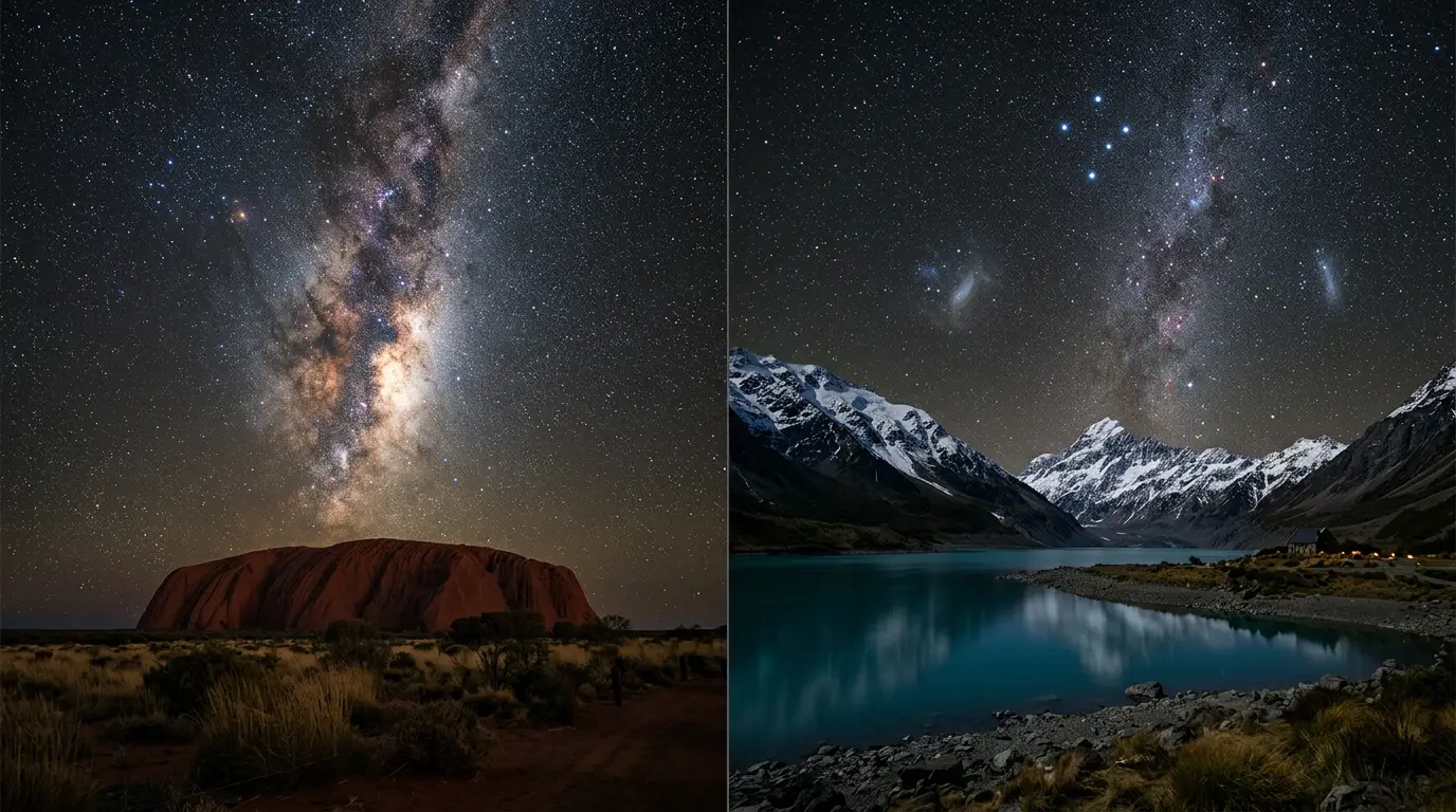

Same sky, different trip
Start with what's not in dispute. Both Uluru and Aoraki Mackenzie Stargazing sit far enough south, and far enough from any real city, that the Southern Hemisphere's signature sights show up reliably: the Large and Small Magellanic Clouds visible to the naked eye, the Southern Cross riding circumpolar so it never dips below the horizon, and a galactic core that climbs directly overhead rather than skimming a hazy skyline the way it does from most of Europe or North America. Neither destination has to argue for its sky, and neither traveler standing under either one is getting a lesser view.
What they don't share is how that sky got protected, what surrounds it, or how hard it is to reach. Aoraki Mackenzie earned its darkness through a paper trail: a certified Gold Tier International Dark Sky Reserve, one of the highest tiers a reserve can hold, with lighting ordinances written into Lake Tekapo's municipal code. Uluru earned its darkness through geography and a different kind of governance entirely: Anangu Traditional Owners and Parks Australia have jointly managed Uluru-Kata Tjuta National Park since a 1985 land handback[1], and no dark-sky authority has measured or certified the park's sky the way the International Dark-Sky Association measured Aoraki Mackenzie's. That's the real fork in this comparison, not which sky is darker.
Governance: Anangu co-management vs. Gold Tier certification
Uluru-Kata Tjuta National Park is not run by a park service alone. Title to the land was handed back to its Traditional Owners in 1985, and the park has been jointly managed by Anangu and the Australian Government ever since. Tjukurpa, Anangu traditional law, knowledge, and religious philosophy, guides everything that happens inside the park[2], not as a cultural add-on but as the operating framework: it shapes where visitors can walk, what can be photographed, and how the rock itself is discussed. The park's joint management board has 12 members, eight of them Aboriginal members nominated by Traditional Owners, with Parks Australia handling the board's day-to-day implementation[3]. That's a genuine co-governance model: Traditional Owners set policy, a government agency executes it, not a government park with an Indigenous advisory panel bolted on. Uluru's dark sky, explained goes deeper into why that governance model, not a certification badge, is what keeps the park's night sky this dark.
Aoraki Mackenzie takes the opposite route to the same outcome. It's a certified International Dark Sky Reserve holding Gold Tier status, one of the highest tiers a reserve can earn, its darkness enforced through lighting ordinances that keep Lake Tekapo's streetlights shielded and low rather than through any land-rights framework. Both models produce a night sky worth flying around the world for, and neither is a lesser version of the other: one protects the sky through Indigenous law and a Traditional Owner-majority board, the other through measured lux readings and a municipal lighting code. If governance itself is part of what you're travelling to see, and for a growing number of visitors it is, this is the sharpest, least obvious line between these two trips.
Featured · Destination
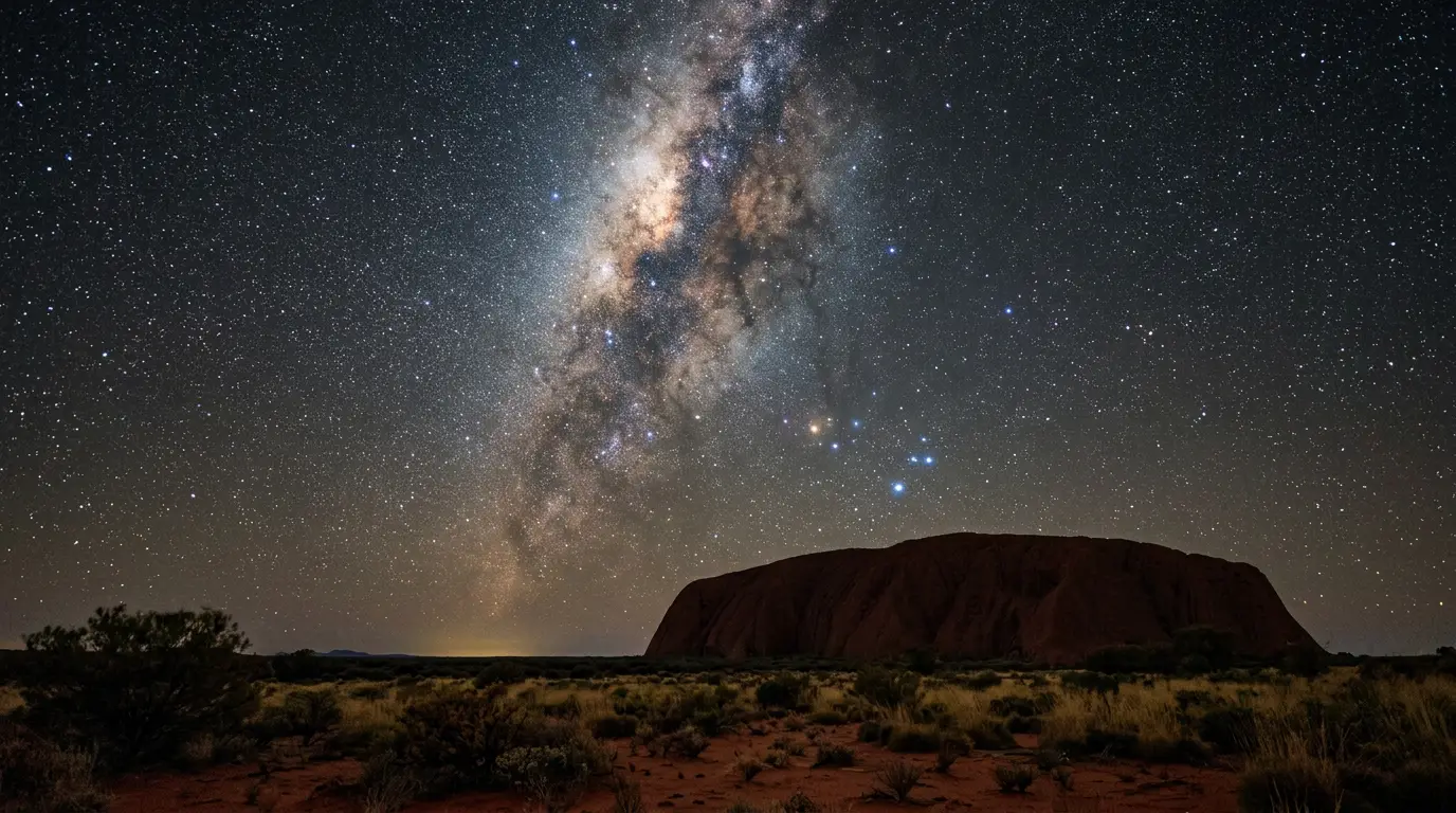
Uluru
Stargaze at Uluru on Anangu-owned, jointly managed land: the Milky Way's core, Magellanic Clouds and Southern Cross over Australia's red-centre outback.
The difference isn't trivia. It changes what you're allowed to do at each site: certain formations at Uluru carry restrictions on photography and access under Tjukurpa, enforced not by a ranger's whim but by cultural law the joint management board upholds. Aoraki Mackenzie's restrictions run the other direction, on light output rather than access: hotels, streetlights, and even headlights on the road into Lake Tekapo are subject to shielding rules that keep the reserve dark. Both sets of rules exist to protect something real. Read them as part of the trip, not as fine print to skip.
Landscape and foreground: a desert monolith vs an alpine lake district
Uluru's foreground is the monolith itself: a single sandstone inselberg standing 348 metres high and rising 863 metres above sea level, with a base perimeter of 9.4 kilometres[4]. Walk, drive, or fly toward it from any direction and the rock dominates a flat horizon with nothing else competing for the frame; the Red Centre desert around it runs to a horizon empty enough that a wide-angle night shot needs no cropping. Uluru-Kata Tjuta National Park is UNESCO World Heritage-listed and recognized as one of Australia's most important Indigenous cultural sites[5], a status that travels with the landscape whether or not a camera is pointed at the sky. The park's hot desert climate delivers just 284.6 millimetres of rain a year[6], so the odds of a clear night stay high almost regardless of when you show up.
Aoraki Mackenzie is the opposite kind of foreground. The reserve spans the Mackenzie Basin and Aoraki/Mount Cook National Park, an alpine lake district where Lake Tekapo, the Southern Alps, and a working research observatory on Mount John share the frame with the sky. The Church of the Good Shepherd, a small stone chapel on the Lake Tekapo shoreline, has become the country's most photographed night-sky foreground precisely because it's small: a low, dark silhouette against water and mountains, not a monolith that fills the frame on its own. Desert monolith versus alpine lake district is the cleanest way to put it, and it's a genuinely opposite visual experience under a broadly similar sky.
Desert monolith versus alpine lake district is the cleanest way to put it, and it's a genuinely opposite visual experience under a broadly similar sky.
The two nights differ physically as much as visually, even though the stars overhead are nearly the same. Desert terrain like Uluru's holds daytime heat well into the night, with the sandstone itself radiating stored warmth for hours after sunset, and cicadas and wind are the sounds visitors most often report out there after dark. At Aoraki Mackenzie, the cold sets in fast once the sun drops behind the Southern Alps, and the lake adds its own soundtrack: wind off the water and the occasional car on the road to Tekapo township. Neither night is better. They're simply not the same kind of cold, or the same kind of quiet.
Getting there: outback interior vs a South Island road trip
Getting to Uluru means flying into the middle of a continent. Most visitors land at Ayers Rock Airport near Yulara or fly into Alice Springs first; either way, Uluru sits about 335 kilometres southwest of Alice Springs, the nearest sizeable town, with the closest settlement, Yulara, about 17-18 kilometres from the rock by road[7]. There's no meaningful public transport and no shortcut: you fly deep into the outback interior, and the last stretch of sealed highway is the only way in, whichever airport you land at.
Recommended tours
Tours are selected for quality, not commission. I earn a small fee if you book — at no extra cost to you.
Getting to Aoraki Mackenzie means flying into a country, then driving into a mountain range. Long-haul travelers land in Auckland or Christchurch, then either take a domestic connection or drive roughly three hours from Christchurch via State Highway 1 and 8, or two hours from Queenstown over the scenic Lindis Pass, into the Mackenzie Basin. Both trips are genuine long-haul commitments for anyone starting in the Northern Hemisphere: Uluru's last mile is a flight into a remote interior, Aoraki's is a scenic drive after landing on New Zealand's South Island. Rent a car either way; neither destination has public transport reaching the sky, and self-driving is what lets you chase a clearer patch of horizon if a forecast shifts on the day. Neither drive nor flight is glamorous by itself, but the last hour into either destination is where the trip actually starts feeling remote: red dirt and spinifex closing in around the highway to Uluru, or the Mackenzie Basin's tussock plains opening up once the road drops out of the Lindis Pass.
Featured · Article
What Is Astrotourism? The Complete Beginner's Guide
Astrotourism means travel built around dark skies: meteor showers, auroras, the Milky Way. What it means, where to go, and how to plan your first trip.
Booking the sky: a single licensed operator at each destination
Both destinations gate their premium after-dark experience through one flagship, licensed operator, an odd parallel for two places that differ on almost everything else. Uluru Astro Tours markets itself as the only stargazing tour licensed to operate at night inside Uluru-Kata Tjuta National Park: a 2.5-hour guided session with telescope viewing, an interactive star talk, and a night-sky photo, priced at $139 AUD for adults aged 16 and up and $90 AUD for children aged 2 to 15[8]. Book ahead; slots are small by design, and the driest, clearest months of the dry season sell out first.
Aoraki Mackenzie's equivalent is Dark Sky Project's Summit Experience, a shorter but more instrumented session: roughly 1 hour 45 minutes inside a private observatory dome on Mount John, using a 16-inch telescope and led by working astronomy guides, priced at a premium over Uluru's own tour, with a lower child rate for ages 10 and up and younger children not admitted. Confirm current pricing directly with the operator before booking. Neither tour is optional if a serious telescope look is the actual point of your trip: Uluru Astro Tours is the operator to book if its self-described exclusive night licence holds, and Mount John's dome is the only public telescope of that size in the reserve. Whichever operator you book, treat cloud cover as the real gatekeeper, not availability: both destinations lose more tour nights to weather than to sold-out slots. Pack for the temperature swing regardless of which one you book: the desert cools fast after a hot day, and the alpine air drops well below freezing even in the shoulder season. For a full season-by-season breakdown of when to book either one, see the best time to see stars at Uluru.
$139 AUD
How to choose
There's no honest version of this comparison that ends with a single winner. Both destinations sit under genuinely dark Southern Hemisphere skies, both gate their best guided experience through a single licensed operator, and both demand a real travel commitment to reach. What actually differs is governance, landscape, and how you want to spend the daylight hours between stargazing sessions.
For where Aoraki Mackenzie's Gold Tier status sits among the world's other certified reserves, see the guide to the world's best dark sky parks. If Aoraki Mackenzie wins your comparison, the guide to the best places to stay for stargazing in Aoraki Mackenzie covers the lodging shortlist in full.
| Factor | Uluru | Aoraki Mackenzie |
|---|---|---|
| Governance | Co-managed by Anangu Traditional Owners and Parks Australia since 1985 | Certified IDA Gold Tier International Dark Sky Reserve |
| Sky certification | None; no measured Bortle rating on record | Bortle Class 2, certified Gold Tier |
| Landscape | Single sandstone inselberg, Red Centre desert | Alpine lake district, Southern Alps, Mount John Observatory |
| Flagship night tour | Uluru Astro Tours, $139 AUD adult | Dark Sky Project Summit Experience, adult rate on request |
| Nearest hub | Yulara, about 17-18 km from the rock | Lake Tekapo township |
| Getting there | Flight into Ayers Rock Airport or Alice Springs, then highway | Flight to Auckland or Christchurch, then drive from Christchurch or Queenstown |
Pick Uluru if
- You want to stargaze on land that is co-managed under Anangu law rather than a technical certification
- You'd rather have a single sandstone monolith fill the frame than an alpine lake district
- You're comfortable with no formal dark-sky certification in exchange for a drier, more remote desert sky
- You want to pair the trip with Central Australia's outback rather than a mountain drive
Pick Aoraki Mackenzie if
- You want a measured, certified Bortle Class 2 sky with a Gold Tier badge behind the claim
- You'd rather photograph a lakeside chapel and the Southern Alps than a single rock
- You're planning to combine stargazing with hiking beneath New Zealand's tallest peak
- A scenic mountain drive after landing beats a flight into a remote desert interior